Running Trails and Routes
This page for Juneau, Alaska area runners is a perpetual work in progress. If you would like to share your favorite running routes with fellow runners, please send a write-up to the webmaster. Please include route description, route map, distance, elevation profile, etc.
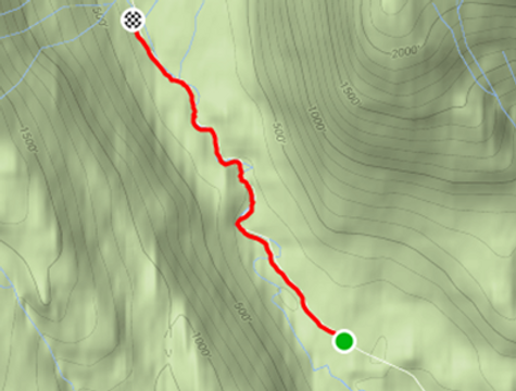
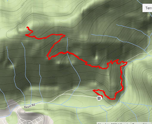
Trail descriptions and maps are down below, each with an overview map, in alphabetical order.
Difficulty ratings range from: easy, moderate, difficult, very difficult, strenuous.
Seeking input for these and other ideas:
-
Twin Lake Trail
-
Thane Road / DuPont Trail
-
Brotherhood Bridge Trail
-
Under Thunder Trail
Juneau Area Trails on other sites
-
Trailmix - Our non-profit trail heroes share information about Juneau hiking trails
-
Juneau Nordic Ski Club - The communications hub for Nordic skiers in Juneau, Alaska
-
Hiking in Juneau - A local Juneau hiking group sponsored by CBJ Parks and Rec
-
The Chilkoot - Information about the historic gold-mine era Chilkoot Trail, up by SkaGway
-
Southeast Alaska Trails--SEATrails - Community-focused trail system inter-connected by Alaska's Marine Highway System
-
Adventure Flow - Local guides share info about local trails, grouped by area
-
Juneau Trails - A listing of some Juneau area trails from Alaska Trekker
-
Juneau Topographic Map - Interactive topographic map of Juneau area from Topozone

Airport Dike Trail
Distance: 3.4 miles roundtrip
Elevation Gain: None
Time required: 30 min to 1 hour
Difficulty: Easy to Moderate
Trail Description: Start at the Airport Dike Trail parking lot. This trail is a gravel access road circling the Juneau airport property. There are side trails for access the wetland. Tons of walkers, runners, and dogs. One of the most popular trail in Juneau. No elevation change.

Auke Lake Trail
Distance: Around 2 miles roundtrip
Elevation Gain: 150 feet one-way
Time required: 20 to 40 min roundtrip
Difficulty: Easy to Moderate
Trail Description: Start at Auke Lake Trail (Goat Hill on the north end, or along Glacier Highway on the south end). Rolling trail along the east side of Auke Lake. Nice trail to go take a dip in the summer.

Downtown Seawalk
Distance: 1 mile roundtrip
Elevation Gain: None
Time required: 10 to 20 min
Difficulty: Easy
Trail Description: Start at Marine Park in downtown Juneau, and just follow the boardwalk south towards AJ Dock. The boardwalk is about 0.5 one-way. A great way to enjoy the beautiful scenery along Gastineau Channel on a nice day.
A newer, not connected portion of the sea walk is about 1/2 mile toward the big bridge to Douglas Island, just a short walk on the sidewalk along Egan Drive. It offers many features along the way and leads to a beautiful new park with a life-size whale sculpture (a fountain during summer months).
Eaglecrest Ascent
Distance: 2.4 miles one-way
Elevation Gain: 1662 feet
Time required: 1 to 2 hours one-way
Difficulty: Difficult to Very Difficult
Trail Description: Start at Eaglecrest parking lot. Follow the maintenance road and go uphill. The road will continue to the top of Eaglecrest. Amazing place to watch sunrise or sunset.

Montana Creek Trail
Distance: 4 miles roundtrip
Elevation Gain: 180 ft uphill, then 180 ft downhill
Time required: 40 min to 1 hour 30 min
Difficulty: Moderate
Trail Description: Start at the parking lot next to the Outdoor Gun Range. The trail gradually go downhill for 0.5 miles until it crosses Montana Creek via a pedestrian footbridge. The elevation drops about 70 feet.
After crossing the footbridge, follow the wide gravel road and gradually head uphill for 1.5 miles. There is an elevation gain of 180 ft. Turn around when the wide gravel road become a narrow unmaintained trail.

Mt. Juneau Ascent
Distance: 3.4 miles one-way
Elevation Gain: 3758 feet
Time required: 1.5 to 3 hours one-way
Difficulty: Very Difficult to Strenuous
Trail Description: Start at the Perserverance Trailhead parking lot. The first mile follows the Perserverance trail, climbing 250 feet. Then, the trail splits off. The second mile climbs about 1335 feet, through the woods then into the side of Mt Juneau. Then the long switchback begins. The elevation gain for the third mile is about another 900 feet. For the last 0.4 mile, another elevation gain of 500 feet. The run ends on top of Mt Juneau, at an elevation of 3500 feet.

Mt. Roberts Ascent
(to The Cross)
Distance: 2.0 miles one-way
Elevation Gain: 1689 feet
Time required: 1 to 2 hours one-way
Difficulty: Difficult to Very Difficult
Trail Description: Start at the Mt Roberts trailhead at Basin Road. This trail is frequent by local hikers and runners, and it is well maintained. It is a consistent climb to the Cross. Elevation gain for the first mile is about 870 feet, and the elevation gain for the second and last mile is about 790 feet. There are switchbacks in the wooded area before you reach the tram. Above the tram, the vegetation opens up. This run concludes at the Father Brown's Cross.

Nugget Falls Trail
Distance: Around 2 miles roundtrip
Elevation Gain: None
Time required: 20 to 30 min
Difficulty: Easy
Trail Description: Start at Glacier Visitor Center parking lot. Follow the paved path towards Nugget Fall. You can follow the beach route or the main Nugget Fall trail. The trail will end at Nugget Falls. Very crowded during the tourist season.


Perserverance Trail
Distance: 3.25 miles one-way
Elevation Gain: 1595 feet
Time required: 45 min to 90 min one-way
Difficulty: Moderate to Difficult
Trail Description: Start at Basin Road parking lot. Follow the trail and get to the end (broken bridge with waterfall). This is one of the most popular trail in Juneau, and a lot of runners/hikers on this trail.
Peterson Lake Ascent
Distance: 4.3 miles one-way
Elevation Gain: 862 feet
Time required: 1.5 hr to 3 hr one-way
Difficulty: Moderate to Difficult
Trail Description: Start at the Peterson Lake trailhead parking lot. Follow the trail uphill until you reach Peterson Lake. The trail will get increasingly treacherous, as the trail is fairly undeveloped.


Salmon Creek Ascent
Distance: 2 miles one-way
Elevation Gain: 455 feet
Time required: 30 min to 45 min one-way
Difficulty: Moderate to Difficult
Trail Description: Start at Salmon Creek Trail parking lot, follow the maintenance road until you reach the Powerhouse. It is a steep initial climb, but then the trail flatens out. You can continue towards Salmon Creek Dam.
